Log in
All resources
Create a design
485 Free Artworks of Charts And Maps
maps in the rijksmuseum amsterdam
17th-century celestial maps
18th-century celestial maps
maps by gerard valck
gerard valck
prints published by pieter schenk (i)
les forces de l'europe, asie, afrique et amerique, ou description des principales villes, avec leurs fortifications
portolan charts made in the 18th century
bibliothèque nationale de france
1744 fleurons
1671 maps of south america
west-indische compagnie
17th-century maps of the mediterranean sea
portolan charts made in the 17th century
navigantium atque itinerantium bibliotheca
1744 fleurons
baroque painting
animals on maps
van langren map of southeast asia
renaissance
maps by emanuel bowen
1744 fleurons
old maps of the strait of gibraltar
maps in the rijksmuseum amsterdam
maps in the rijksmuseum amsterdam
17th-century celestial maps
battle of the nile
cooper willyams
maps by emanuel bowen
1744 fleurons
18th-century maps of england and wales
chorographia britanniae (1741-1742)
west-indische compagnie
1665
maps in the rijksmuseum amsterdam
17th-century celestial maps
maps in the rijksmuseum amsterdam
maps by frederick de wit
chartae orarum marinarum partim normandiae, partum britanniae, et insularum circa eas sitarum - lucas io(ann)es aurigarius inventor ; ioannes a doetecu. fecit - btv1b531567357
bibliothèque nationale de france
chartae orarum marinarum partim normandiae, partum britanniae, et insularum circa eas sitarum - lucas io(ann)es aurigarius inventor ; ioannes a doetecu. fecit - btv1b531567357
bibliothèque nationale de france
chartae orarum marinarum partim normandiae, partum britanniae, et insularum circa eas sitarum - lucas io(ann)es aurigarius inventor ; ioannes a doetecu. fecit - btv1b531567357
bibliothèque nationale de france
hms chanticleer (ship, 1808)
john heaviside clark
lucas janszoon waghenaer
1588 maps of norway
maps in the rijksmuseum amsterdam
17th-century celestial maps
etchings in the rijksmuseum amsterdam
maps in the rijksmuseum amsterdam
maps of the dutch east india company - india
maps of fort kochi
maps in the rijksmuseum amsterdam
17th-century celestial maps
maps in the rijksmuseum amsterdam
17th-century celestial maps
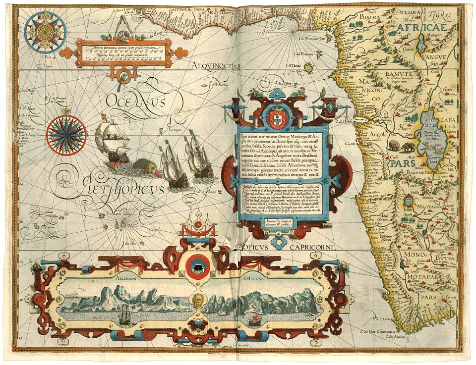
1596 maps of africa
renaissance
maps in the rijksmuseum amsterdam
17th-century celestial maps
maps in the rijksmuseum amsterdam
17th-century celestial maps
navigantium atque itinerantium bibliotheca
1744 fleurons
zee custe van sweeden, ontrent de westerwijck, ende tgatt vann stockholm, beginnende van kalmar tot den wigsteen en rookoe gelegen bynnen tgatt van stockholm alsoe hem tlandt daer verthoont - doer lucas... - btv1b53235860x
bibliothèque nationale de france
zee custe van sweeden, ontrent de westerwijck, ende tgatt vann stockholm, beginnende van kalmar tot den wigsteen en rookoe gelegen bynnen tgatt van stockholm alsoe hem tlandt daer verthoont - doer lucas... - btv1b53235860x
bibliothèque nationale de france
zee custe van sweeden, ontrent de westerwijck, ende tgatt vann stockholm, beginnende van kalmar tot den wigsteen en rookoe gelegen bynnen tgatt van stockholm alsoe hem tlandt daer verthoont - doer lucas... - btv1b53235860x
bibliothèque nationale de france
prints by caspar luyken in the rijksmuseum amsterdam
engravings of birds in the rijksmuseum amsterdam
maps in the rijksmuseum amsterdam
17th-century celestial maps
maps in the rijksmuseum amsterdam
17th-century celestial maps
maps in the rijksmuseum amsterdam
17th-century celestial maps
maps in the rijksmuseum amsterdam
17th-century celestial maps
maps in the rijksmuseum amsterdam
emrik & binger
maps in the rijksmuseum amsterdam
17th-century celestial maps
1740s maps of the americas
1747 maps of north america
maps in the rijksmuseum amsterdam
17th-century celestial maps
etchings in the rijksmuseum amsterdam
carolus allard
maps in the rijksmuseum amsterdam
17th-century celestial maps
maps in the rijksmuseum amsterdam
17th-century celestial maps
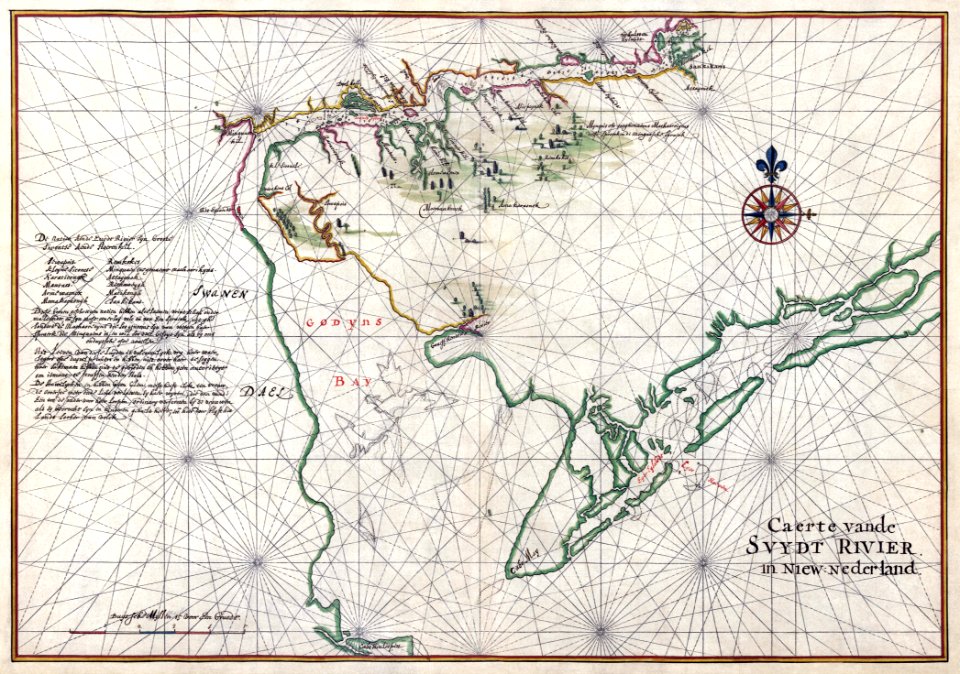
old maps of the delaware bay
1639 maps
maps in the rijksmuseum amsterdam
17th-century celestial maps
maps in the rijksmuseum amsterdam
17th-century celestial maps
maps in the rijksmuseum amsterdam
david coster
maps in the rijksmuseum amsterdam
17th-century celestial maps
maps in the rijksmuseum amsterdam
17th-century celestial maps
maps in the rijksmuseum amsterdam
17th-century celestial maps
les forces de l'europe, asie, afrique et amerique, ou description des principales villes, avec leurs fortifications
maps of the history of poitou
atlas vingboons
1665
maps of the west-indische compagnie
1677
maps in the rijksmuseum amsterdam
17th-century celestial maps
maps in the rijksmuseum amsterdam
17th-century celestial maps
maps in the rijksmuseum amsterdam
17th-century celestial maps
maps in the rijksmuseum amsterdam
17th-century celestial maps
maps in the rijksmuseum amsterdam
17th-century celestial maps
maps in the rijksmuseum amsterdam
17th-century celestial maps
maps in the rijksmuseum amsterdam
17th-century celestial maps
navigantium atque itinerantium bibliotheca
1744 fleurons
prints by claes jansz. visscher (ii) in the rijksmuseum amsterdam
maps in the rijksmuseum amsterdam
maps in the rijksmuseum amsterdam
maps by willem and johannes blaeu
maps of the west-indische compagnie
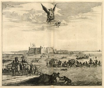
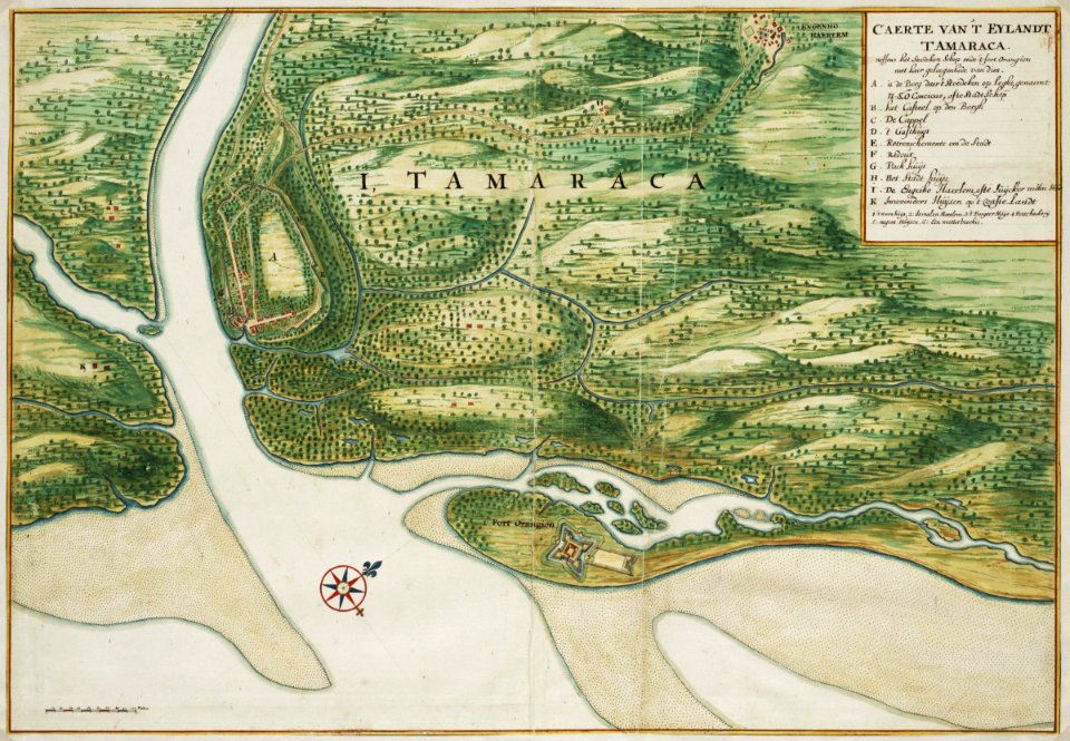
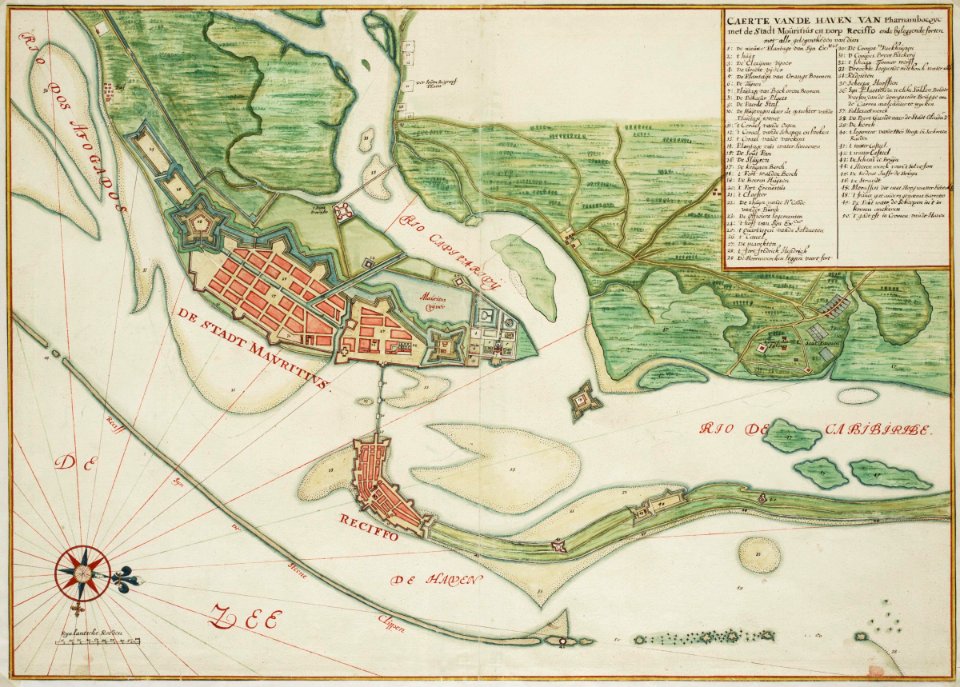
old maps of dutch brazil
les forces de l'europe, asie, afrique et amerique, ou description des principales villes, avec leurs fortifications
portolan charts made in the 18th century
les forces de l'europe, asie, afrique et amerique, ou description des principales villes, avec leurs fortifications
portolan charts made in the 18th century
prints by cornelis danckerts (i) in the rijksmuseum amsterdam
prints by dancker danckerts in the rijksmuseum amsterdam
german renaissance
1744 fleurons
maps in the rijksmuseum amsterdam
jacobus harrewijn
prints, drawings and watercolours of the royal museums greenwich
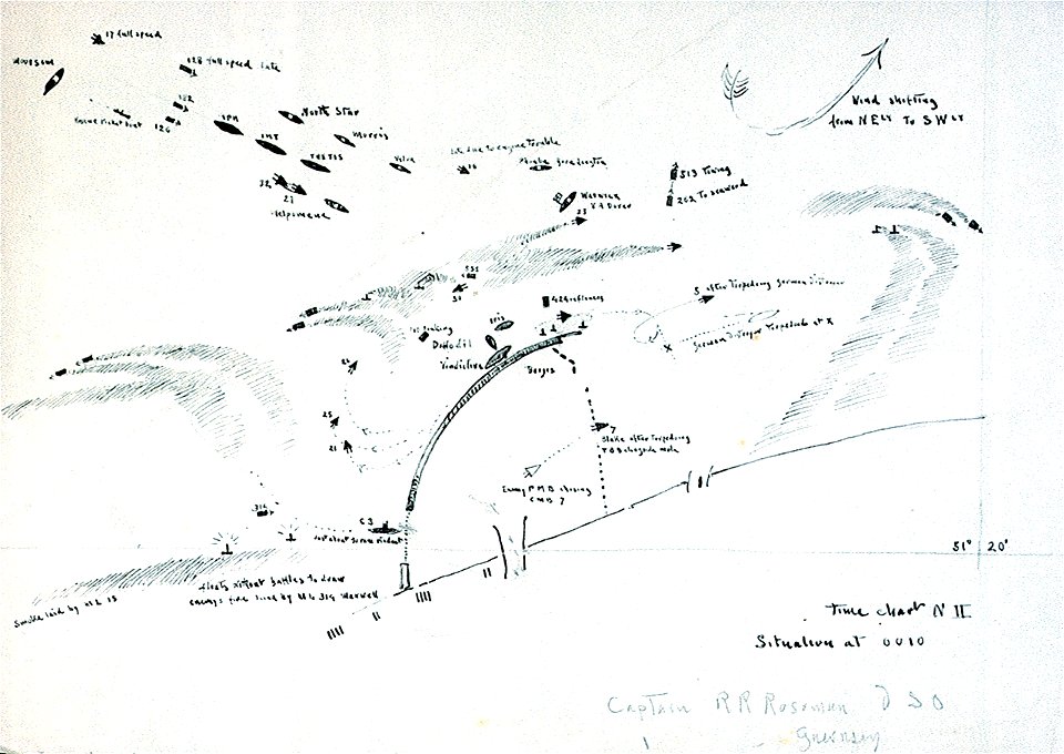
zeebrugge raid maps
maps in the rijksmuseum amsterdam
maps by gerard valck
photographs of prison saint-lazare in musée carnavalet
photographs of prison saint-lazare in musée carnavalet
les forces de l'europe, asie, afrique et amerique, ou description des principales villes, avec leurs fortifications
portolan charts made in the 18th century
les forces de l'europe, asie, afrique et amerique, ou description des principales villes, avec leurs fortifications
portolan charts made in the 18th century
maps in the rijksmuseum amsterdam
maps by gerard valck
les forces de l'europe, asie, afrique et amerique, ou description des principales villes, avec leurs fortifications
portolan charts made in the 18th century
les forces de l'europe, asie, afrique et amerique, ou description des principales villes, avec leurs fortifications
portolan charts made in the 18th century
les forces de l'europe, asie, afrique et amerique, ou description des principales villes, avec leurs fortifications
portolan charts made in the 18th century
les forces de l'europe, asie, afrique et amerique, ou description des principales villes, avec leurs fortifications
portolan charts made in the 18th century
les forces de l'europe, asie, afrique et amerique, ou description des principales villes, avec leurs fortifications
portolan charts made in the 18th century
maps in the rijksmuseum amsterdam
johannes de broen
prints by james gillray in the british museum
satirical prints in the british museum
prints by james gillray in the british museum
satirical prints in the british museum
maps in the rijksmuseum amsterdam
dutch baroque architecture
401 - 485 of 485
/ 5